NORTH EAST VIC:
RECENT OBSERVATIONS
UPDATED: 3RD / AUGUST /2018
REPORT CONFIDENCE: STRONG
CURRENT UNTIL: 6TH / AUGUST/ 2018
OBSERVATION SUMMARY
TREND: IMPROVING / ONGOING / DETERIORATING
OBSERVATION:
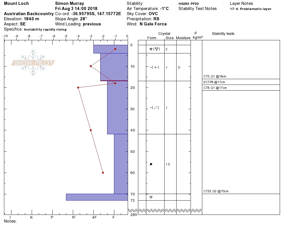
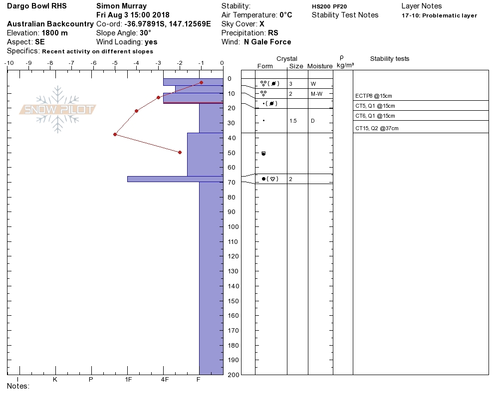
Things got pretty wet there for a bit. Then as the next low wedged in the temp dropped and the snow started. Out in that muck we ran some field observation, well overdue. We'd noted a few small 'natural' slides out and about. Wednesdays freaky new snowfall has a super subtle crust which is producing fast easy results. By tomorrow morning (Saturday AM) we will likely push the hazard rating to 'Considerable' given that the wet old and the new snow have bonded well enough to provide cohesive 'top heavy' packed pow and wet slabs that are propagating easily under ski. The steeper the easier the trigger due we figure to it being 'top heavy'. Avoid steep leeward terrain (lee to the north and west).
OUTLOOK:
Pretty classic mid winter conditions now, with a steady conveyor from the south delivering fronts at roughly 48hr intervals. Looks to continue for the period now until out next update.
Always a big thanks to everyone who is helping make this possible through our membership kickstart and through our merchandise drive. Simon@MSC

PRIMARY HAZARD
FROM SATURDAY 8AM
This weak layer is prevalent on all aspects, with a heightened potential for 'considerable' avalanche danger on aspects subject to wind loading, not defined yet as the storm is mid flight, So check here to ascertain the loaded aspects. Wind Graph Wind Graph