NORTH EAST VIC:
RECENT OBSERVATIONS
UPDATED: 30th / AUGUST /2018
REPORT CONFIDENCE: STRONG
CURRENT UNTIL: 3RD / SEPTEMBER / 2018
OBSERVATION SUMMARY
TREND: IMPROVING / ONGOING / DETERIORATING
CURRENT OBSERVATION:
The last week has seen the snowpack move into a continued freeze / thaw cycle, with isolated pockets of softer dry snow on shady aspects.
Blizzard Warning Current.
OUTLOOK:
There is an advancing cold front about to arrive, although not as cold as we've been seeing lately so it will be likely that it arrives as a mixture of rain and snow early on Friday morning promoting a good bond with the existing melt freeze crust, then as the wind direction swings westerly, deflecting the warmer air originating inland, the precip will arrive as dryer snow for Saturday, with flurries continuing. Strong winds associated with the onset of the front will create blizzard conditions tomorrow (Friday).
The new snow deposition we are tipping to land 'right side up' and avalanche problems should remain low, becoming moderate (possibly considerable) by Saturday. With fresh obs in Saturday morning, check in again for an update then if your headed backcountry. Expected snowfall of 20cm will by our measure see 60cm+ deposited in aspects lee to the North and West. Conservative terrain choices advised on steep (30˚+) aspects lee to the North and West from Saturday.

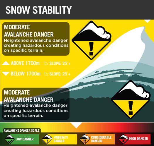
STABILITY SUMMARY: CURRENT

STABILITY SUMMARY FORECAST:
SATURDAY MIDDAY
Primary Hazard
AVALANCHE PROBLEM: WIND SLAB


SECONDARY HAZARD


Tertiary HAZARD
ICE & RIME HAZARDS

Other Hazards:
Cornice Collapse
With a 2m snowpack (4m on windloaded aspects) we are urging people to be careful and stay well clear of the cornices. The stability of these features has improved over this last week, however with rapid warming or rain they will again become prone to collapse.
Creeks and Gullys
Caution required with creek crossings as transported snow from angles North to South and East have created windlips that encircle and thinly conceal deep wider creek holes.
Weather Models
Snowpack Assessments
The EXTRA Column
The information provided here deviates from the standard reporting format that we apply to the travel advisory. It sometimes shows recent field obs results and images. It is pitched at participants looking for more detail.