Date: 24/08/2020
Conditions Summary
Yesterday field teams traveled in the sub-alpine on SE aspects.
The snow was still good riding, but was heavier than the day before. Sun effect was evident on northerly aspects and a thin melt freeze crust on an easterly aspect was noted in the afternoon.
Slope tests showed no signs of instability within the snowpack at these elevations.
Alpine Hazards


Sub-Alpine Hazards


Daily Discussion
During the storm, all of our travels were in the sub-alpine. We have good confidence with the conditions at this elevation.
The uncertainty lies in the alpine where today is the first chance that people have to get a good look around. Although we are out of considerable avalanche hazard, a rating of moderate means human triggered avalanches are still possible. Evaluate snow and terrain carefully. Remember, our main concerns are wind slabs and cornices.
Bring an extra layer as the temperatures are forecast to remain cold today.
Confidence: MODERATE
First foray into the alpine since the storm.
Avalanche Problems
Primary Problem
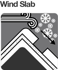
The primary concerns in the alpine are wind slabs and cornices.
Evaluate snow and terrain carefully; identify features of concern.


We need your eyes too. If you’ve been in the backcountry we’d love to know what you have seen. Every little bit helps.
Weather Summary
Cloudy. Medium (40%) chance of snow showers. Winds west to southwesterly 15 to 25 km/h becoming light in the evening. (Source: BOM)