Date: 22/08/2020
Conditions Summary
Yesterday a field team traveled between 1700-2050m on mainly S and SE aspects. Travel was in terrain less than 30 degrees and visibility was poor with gusty westerly winds and snow showers during the day. There was approximately 20cm of fresh snow that skied well but was heavy in places.
There were no observations in the alpine.
Alpine Hazards


Sub-Alpine Hazards


Daily Discussion
Brrr. There has been a drop in temperature overnight and the freezing level is currently 900m. We are now up to approximately 66cm of storm snow at 1730m and the strong winds continue from the NW.
It is going to be another stormy day. Be prepared for whiteout navigation and carry an extra layer for the wintery conditions.
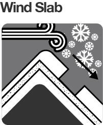
In the alpine, windslabs are the primary concern from the NW winds. Conservative route finding and careful snowpack evaluation are essential.
Also in the alpine beware of cornices. The new cornice development the past few days is likely touchy and may pull back further that you expect.
In the sub-alpine, there have been some instabilities within the storm snow noted from testing. Evaluate snow and terrain carefully and identify areas of concern.
Forecast Confidence: STRONG
Avalanche Problems
Primary Problem
Careful snowpack evaluation, cautious route-finding and conservative decision-making essential.


Secondary Problem

Evaluate snow and terrain carefully; identify areas of concern.


We need your eyes too. If you’ve been in the backcountry we’d love to know what you have seen. Every little bit helps.
Weather Summary
Cloudy. Very high (95%) chance of snow showers. The chance of thunder and small hail during the afternoon. Winds westerly 30 to 40 km/h decreasing to 20 to 30 km/h in the evening. (Source: BOM)