Date / Region: 14/07/2020 NSWMainRange
Advisory Confidence: LOW - No observations from Alpine
Mountain environments can be categorised as above or below the tree line, thus Alpine and Subalpine respectively. Find out more about how these types of terrain can create or mitigate backcountry hazards here.
Travel & Terrain advice:
A large degree of caution in the alpine is recommended due to low visibility and considerable avalanche hazard. Avoid convexities and lee slopes above 25 degrees. In the sub-alpine there is the moderate avalanche hazard due to possibility of storm slabs. Make conservative decisions. Shallow areas around bushes may collapse under weight. Snow will be heavy and there may be areas of breakable crust. This snowfall will set up the Main Range for great travel once the storm moves off to the east.
Primary Avalanche Problem
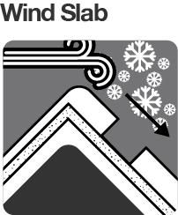
With moderate winds from the E-SE in the last 24 hours and over 60cm of new snow, windslabs may have developed in the Alpine to size 2. Naturally-triggered possible, human-triggered likely on north through to west aspects. This is an unusual aspect for a wind slab problem on the Main Range, due to the atypical flow of this storm from the E-SE.
Secondary Avalanche Problem
Storms slabs possible in the Alpine and Sub-Alpine on all aspects.
We need your eyes too. If you’ve been touring in the Alpine National Park we’d love to know what you have seen. Every little bit helps.
Observations Summary
Snow Surface Conditions Summary
Storm total 70cm of new snow with more at higher elevations. Snow is heavy and will be wet down low. Breakable crust in some areas. Below treeline there is storm debris and without a base in places the snow will collapse with weight.
Windward aspects: E - SE - S - SW
Leeward aspects: NE - W - NW - N - NE
Weather Summary
Low to moderate SE-SW winds with stronger gusts in the Alpine. Temps ranging from -1 to 1. The low which has brought these snowfalls will move away to the east in the second half of the week to be replaced by a ridge of high pressure. [Source:BOM]


