NORTH EAST VIC: RECENT OBSERVATIONS
Updated: 1st September 2017
REPORT CONFIDENCE: MODERATE
There is a new storm cycle moving in Saturday afternoon. Carried on a heap of breeze. Solid 80km/h with gusts in the 100's so expect to have to chainsaw your way out of all the more remote trail heads. Once the front has pushed through the following systems are going to see a pretty constant smattering of bullet fronts and more prolonged blizzard conditions climaxing around Tuesday.
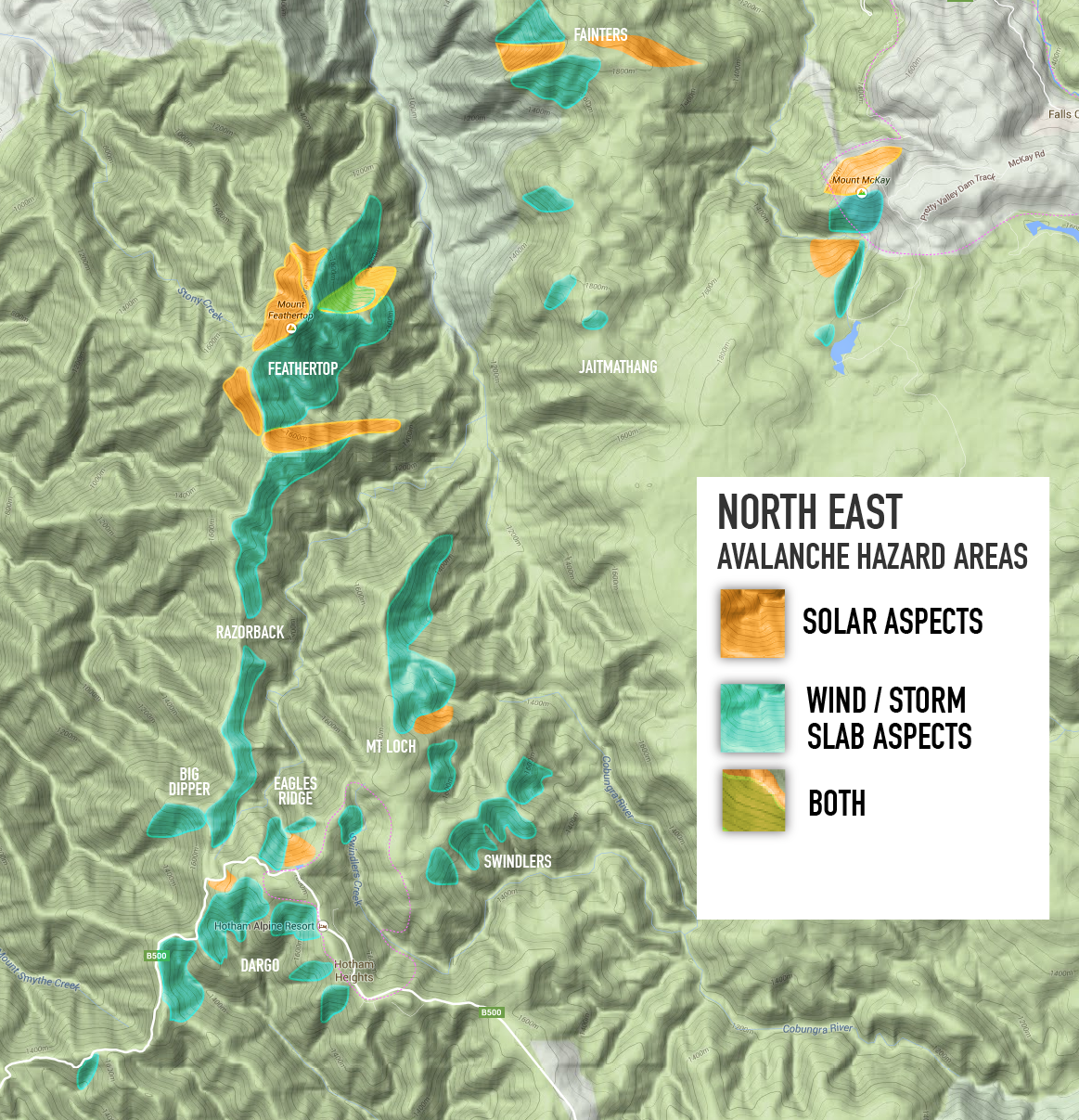
We are forecasting for moderate avalanche hazards to develop on aspects lee to the North and West. If the rain carried by the front is minimal, and the cooler push (into sunday morning) delivers snow in the region of 25>35cm+ overnight, that could tip that hazard to considerable, given the bed surface will be the 'boilerplate' melt freeze prevalent on all south facing aspects above 1750. The wind direction being N/NW is going to make the accumulation bang on true S/SE aspect which total bulletproof rime/stugi/crust. Maybe all that detail helps it bond? Not keen to find out.
So hopefully it rains... yes, we just said that! The boilerplate needs a good drenching create decent cohesion. Same problem in NSW so a little suffering means she'll settle better quicker right? Its a positive.
We dont have a dial for the trend but from here, friday night, through until monday night the hazard is increasing on both fronts, conditions and avalanches. With Sunday afternoon seeing the ranges likely displaying plenty of yellow cards. Keeps your eyes and ears on the hunt for clues. Perfectly likely that it could get desperately sketchy. We will be following it keenly so do stay tuned...


WITH THE FOLLOWING Moving Into (Sunday-Monday):


INCIDENT REPORT

On Sunday 27th August at approx 3pm a skier was traversing from Hells Gap (the col to the east of the junction of Eskdale Spur and the ridge) towards Eskdale Spur on the north-east aspect and had traversed approximately 100m when he was caught in an avalanche. The skier was able to keep his upper body above the snow was carried approx 80m until the avalanche came to a halt. He was able to dig his legs and skis out from the debris and was uninjured.
The release point of the avalanche occurred just below the NE ridge near the top of the rollover, and had a width of >100m. The travel distance was approx 150m. The crown height was not observed directly but the depth of the slab was estimated to be 30cm.
Conditions: The previous day was a melt freeze, with 10cm snow falling overnight from the NW-WNW and during the morning the wind direction changed to SE with a maximum strength of approx 80-90 km/hr.
Three other skiers were in the party, two of whom had climbed west up the ridge pole line to the Eskdale Spur junction and the other skier skied down Hells Gap and checked that the skier caught in the slide was OK.
JOIN THE COLLECTIVE
Want to join the MSC, get the latest 'down load' and maybe even help out some how? Jump on board... there are big things happening here: find out more.
Snowpack Assessments
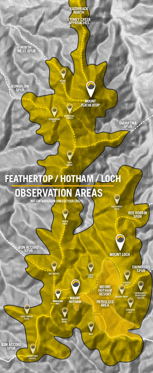
The schedule for stability assessment reports will be Thursdays and Mondays. The locations chosen are purposefully 'wind loaded' so that the exaggerated results are easier to asses. Locations are on or above tree-line and generally South East aspect, although this is conditions dependent. These assessments are the average of multiple pit tests to give you a more comprehensive view of the snowpack.


recent AssesSments


Sed purus sem, scelerisque ac rhoncus eget, porttitor nec odio. Lorem ipsum dolor sit amet.