NORTH EAST VIC
CONDITIONS SUMMARY
UPDATED: 24th AUGUST 2019
REPORT CONFIDENCE: STRONG
CURRENT UNTIL: 28TH AUGUST 2019
Click to enlarge
IMPORTANT: The following information is provided in good faith. Both the observation and forecasting methods used to provide this summary are not consistent with international standard. They are based in the collective experience of those providing input on the conditions, the hazards and the respective rating if provided. Due to both the spatial and often subjective nature of the observation input available, forecasting is at best an estimate. Understanding, knowledge and practise in self assessment of alpine hazards is crucial to safe backcountry travel in all alpine areas covered here.
CONDITIONS SUMMARY
OBSERVED HAZARDS & ACTIVITY
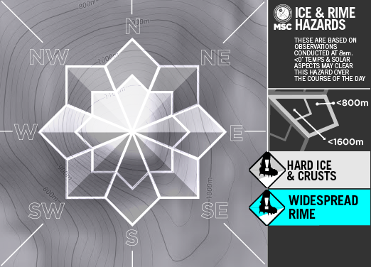
Extensive Bulletproof Ice: all aspects from 2000m to 1200m.
PRIMARY HAZARD
Current Snowpack Conditions
24th August 2019: What a difference a week makes. The last few days we’ve seen a frozen drizzle event (not sure if thats an actual thing). The snowpack consists of a very hard and now quite deep 15cm freeze thaw + rain crust with a ‘toffee’ coated 3mm on top. Beneath is medium density still quite cold -2˚ snow to 75cm where the early August storm deposition meets the previous July snow, isothermal and in places getting funky with some rotten long big crystals.
CONDITIONS Outlook
IMPROVING / ONGOING / DETERIORATING
There’s a bit of a blast due to sweep the state tonight. Brace yourselves. Another front due Wednesday night with a little more precipitation associated. Between now and then another mixed bag as the southern ocean choose to throw whatever it’s got just lying around, at us. SM
Mount Hotham RESORT
BACKCOUNTRY CONDITIONS:
24th August 2019: The base has had another solid freeze overnight. Solar aspects protected from the wind may soften for good spring like turns as the day warms, and there may still be some patches of shallow dry snow on the higher and more south facing aspects. However most south facing slopes will stay rock hard all day so be very cautious of any steep slopes. Take Care.. BB
FALLS CREEK RESORT
BACKCOUNTRY CONDITIONS:
FEATHERTOP
ALPINE NATIONAL PARK
BACKCOUNTRY CONDITIONS:


