NORTH EAST VIC:
RECENT OBSERVATIONS
UPDATED: 17th / AUGUST /2018
REPORT CONFIDENCE: MODERATE
CURRENT UNTIL: 20TH / AUGUST/ 2018
OBSERVATION SUMMARY
TREND: IMPROVING / ONGOING / DETERIORATING
CURRENT OBSERVATION:
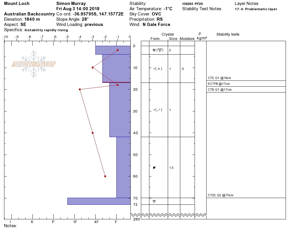
There's a crust at between 3cm and 8cm on all aspects (particularly South and West), with a dusting of fresh on top. The crust itself varies from the 'Toffee' coated hard super thin (2mm) variety through to polystyrene (5cm) 'crudst'. This is sitting on cold snow that has mended on the previous deposition 40cm down (this caused the D3 natural slide noted at Mt Bogong). In short the temperature gradient (from -6 to -1 and back to -5 in the top 12cm) is less than ideal as we...
OUTLOOK: ... look forward to this next 'double whammy' of storms (Blizzards). Starting tonight through until Sunday, and given the state of the bed surface we are again calling for 'considerable' avalanche danger in the alpine on aspects lee to the North and West.
Then the wind swings south westerly and southerly, and quite strong so there will also be strong transportation taking place overnight with those previously 'rimey' faces becoming wind loaded, to what extent depends on how transportable the snow will be, the wind is tipped at 70km. This will throw that north east aspect into being a sweet spot for wind slab avalanche hazard.
There's an army of avy course students who have picked a good week to study so there will be plenty of eyes on the hills thanks to the instructors, and we will take a good look ourselves at the new deposition on Monday morning and issue an update after that. Depending on how those obs pan out we may again nudge the 'High Danger' into Tuesday and Wednesday following the second half of the 'double whammy'. If your out and about and see any natural slides please let us know here or tag @mountainsportscollective on instagram.