NORTH EAST VIC:
RECENT OBSERVATIONS
UPDATED: 12th / AUGUST /2018
REPORT CONFIDENCE: STRONG
CURRENT UNTIL: 13TH / AUGUST/ 2018
OBSERVATION SUMMARY
TREND: IMPROVING / ONGOING / DETERIORATING
CURRENT OBSERVATION:
Sunday Obs
There is some wind loading that has occurred with this last front that has formed a reasonable bond with the existing bed surface. That said there are concerns around pockets of surface hoar that had been observed in the super protected south aspects. Also higher up where the wind loading is more prevalent it's probably getting big enough to be a 'considerable' worry.
Saturday Obs
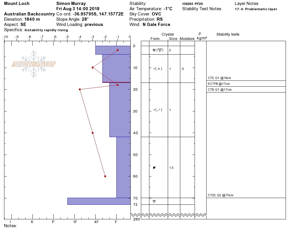
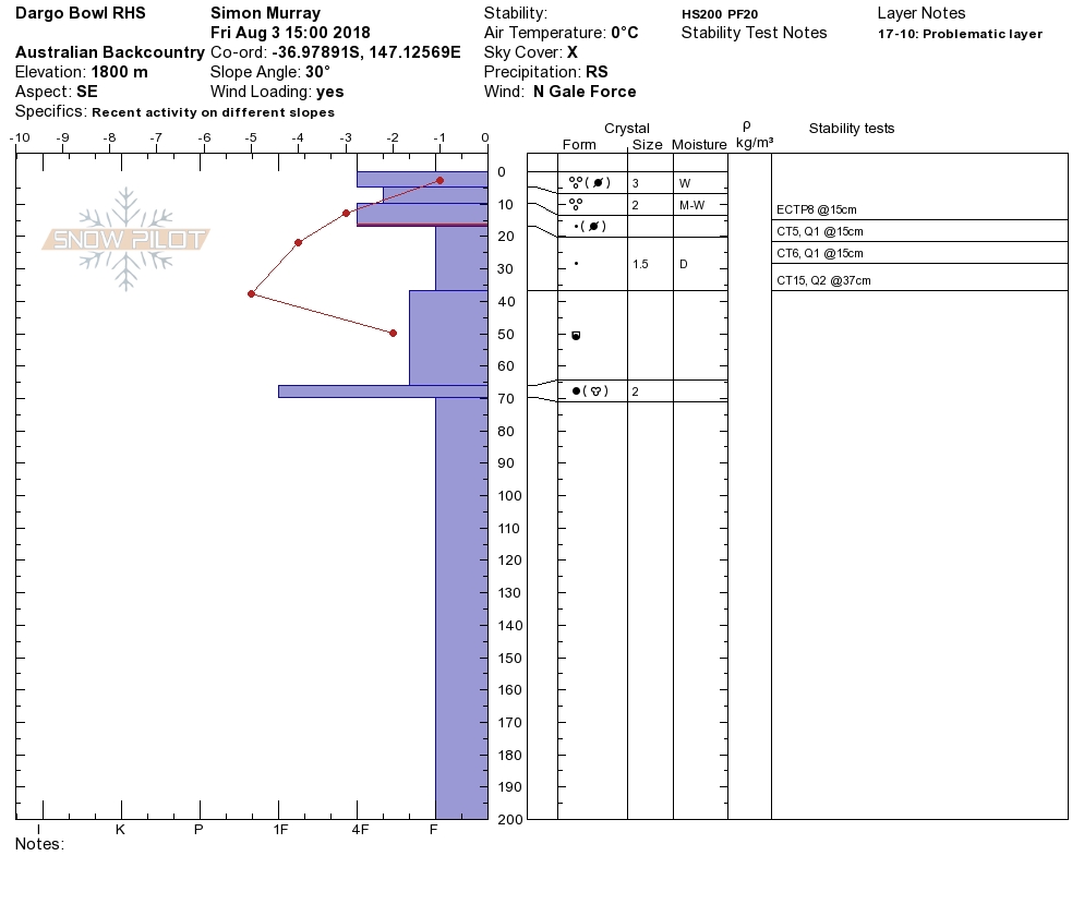
It has been snowing pretty constantly since dawn. We have a pretty nice cohesive bed surface on leewards aspects in the form of some pre-frontal moisture mixed with this early fresh deposition. This is on a 3cm freeze crust that was more 'polystyrene' than shield ice. All in all, for now... things are looking. Still very hard mix of rime, sastrugi and wind crust on north and west aspects. In the last 24hrs we have run field observations across Bogong, Hotham (Dargo & Mt Loch) and Buffalo. The consistency of profile and surface conditions by altitude in this region is very strong at the moment.
OUTLOOK: This week is shaping up to get pretty rowdy, wednesday onwards looks to be bringing some precip with a bunch of wind associated with it so if your planning a longer tour as many are over the next fortnight, keep that in check.
Always a big thanks to everyone who is helping make this possible through our membership kickstart and through our merchandise drive. Simon@MSC

STABILITY SUMMARY

PRIMARY WARNING: WIND SLAB
This most recent precipitation event started from the north and west and now has a bit of south in it, so things are swirling which makes the hazard rose almost a complete wrap around. The wind is abating now.