NORTH EAST VIC: RECENT OBSERVATIONS
Updated: 8th September 2017
REPORT CONFIDENCE: STRONG


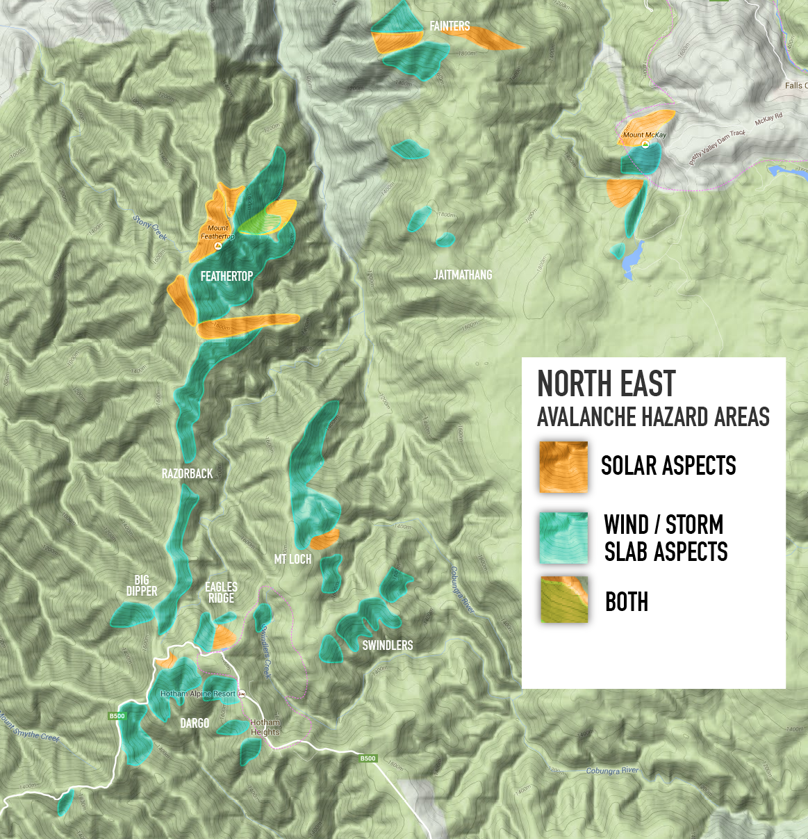
We have got three patrols / profiles in from Vic and there is a freaky consistency to them. All at 1750, so no higher inspection has taken place because its just so epic getting there. We know there are pockets of groupel all over the place, in some places creating freaky easy results yet the bridging strength has kicked in and the nature of the column test would indicate this is a more alarming hazard than what is actually present (would be 'high'). Thats said, if anything goes it will be huge. If you activated the weak groupel layer (45cm down) its likely game over for anyone involved, creating large and destructive slides. We have also had profiles that would indicate the hazard to be well and truely 'moderate'. Mixed bag, consistent groupel, distrubution pattern unknown. Go dig a hole, take a squiz. Make your own assessments based on your specific hill. Because unofficially, with 'considerable' hazard warnings, only experienced BC people (AST1 at least) should be contemplating heading out. And the parties I know of are staying low, and sticking to the trees. Where, coincidentally, it's amazing!
Just a quick note, if you have been hearing the various warnings issues by the emergency services, we'd like to simply state that this is not in any way facilitated by our service. These government agencies have not in anyway attempted to contact, or collaborate, with our project. It's a real shame that whilst yes, we are getting the word out, but in such an alarming fashion that mums wont take kids for a 'boggan just through the alarm that the 'public address' is causing. Because we know, all the 'need to know' peeps of the steep check in here, by the thousand, and that's all it really need be... real good/bad situation.
INCIDENT REPORT

On Sunday 27th August at approx 3pm a skier was traversing from Hells Gap (the col to the east of the junction of Eskdale Spur and the ridge) towards Eskdale Spur on the north-east aspect and had traversed approximately 100m when he was caught in an avalanche. The skier was able to keep his upper body above the snow was carried approx 80m until the avalanche came to a halt. He was able to dig his legs and skis out from the debris and was uninjured.
The release point of the avalanche occurred just below the NE ridge near the top of the rollover, and had a width of >100m. The travel distance was approx 150m. The crown height was not observed directly but the depth of the slab was estimated to be 30cm.
Conditions: The previous day was a melt freeze, with 10cm snow falling overnight from the NW-WNW and during the morning the wind direction changed to SE with a maximum strength of approx 80-90 km/hr.
Three other skiers were in the party, two of whom had climbed west up the ridge pole line to the Eskdale Spur junction and the other skier skied down Hells Gap and checked that the skier caught in the slide was OK.
JOIN THE COLLECTIVE
Want to join the MSC, get the latest 'down load' and maybe even help out some how? Jump on board... there are big things happening here: find out more.
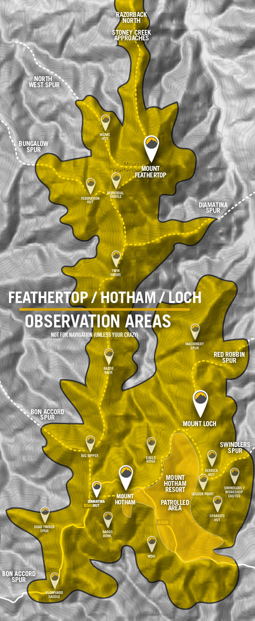
Snowpack Assessments
The schedule for stability assessment reports will be Thursdays and Mondays. The locations chosen are purposefully 'wind loaded' so that the exaggerated results are easier to asses. Locations are on or above tree-line and generally South East aspect, although this is conditions dependent. These assessments are the average of multiple pit tests to give you a more comprehensive view of the snowpack.


recent AssesSments


Lorem ipsum dolor sit amet, consectetur adipiscing elit. Vestibulum id ligula porta felis euismod semper.