Click to enlarge
IMPORTANT: The following information is provided in good faith. Both the observation and forecasting methods used to provide this summary are not consistent with international standard. They are based in the collective experience of those providing input on the conditions, the hazards and the respective rating if provided. Due to both the spatial and often subjective nature of the observation input available, forecasting is at best an estimate. Understanding, knowledge and practise in self assessment of alpine hazards is crucial to safe backcountry travel in all alpine areas covered here.
MAIN RANGE NSW:
RECENT OBSERVATIONS
UPDATED: 14th August 2019
REPORT CONFIDENCE: STRONG
CURRENT UNTIL: 18th AUGUST 2019
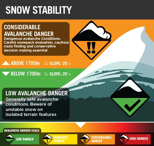
CONDITIONS SUMMARY
Confirming what the data has been pointing at, large slides possible as these top layers find cohesion and begin to ‘slab off’ quicker than the mending in the layers of the pack or the bonding to the warmer slick bed surface (-2˚) . It’s super cold down there in the new snow (-5˚ / -8˚ higher up) so this hazard is ongoing.
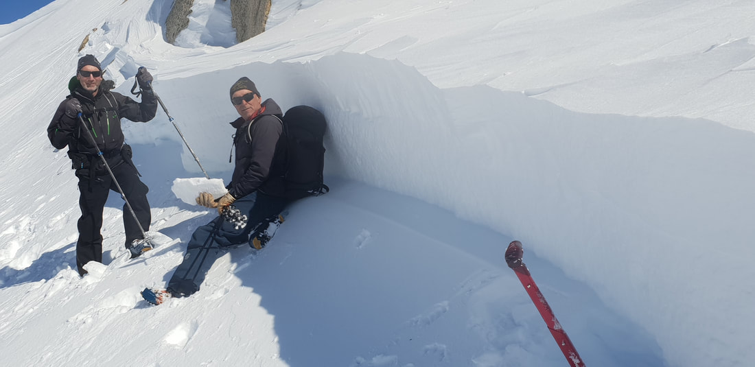
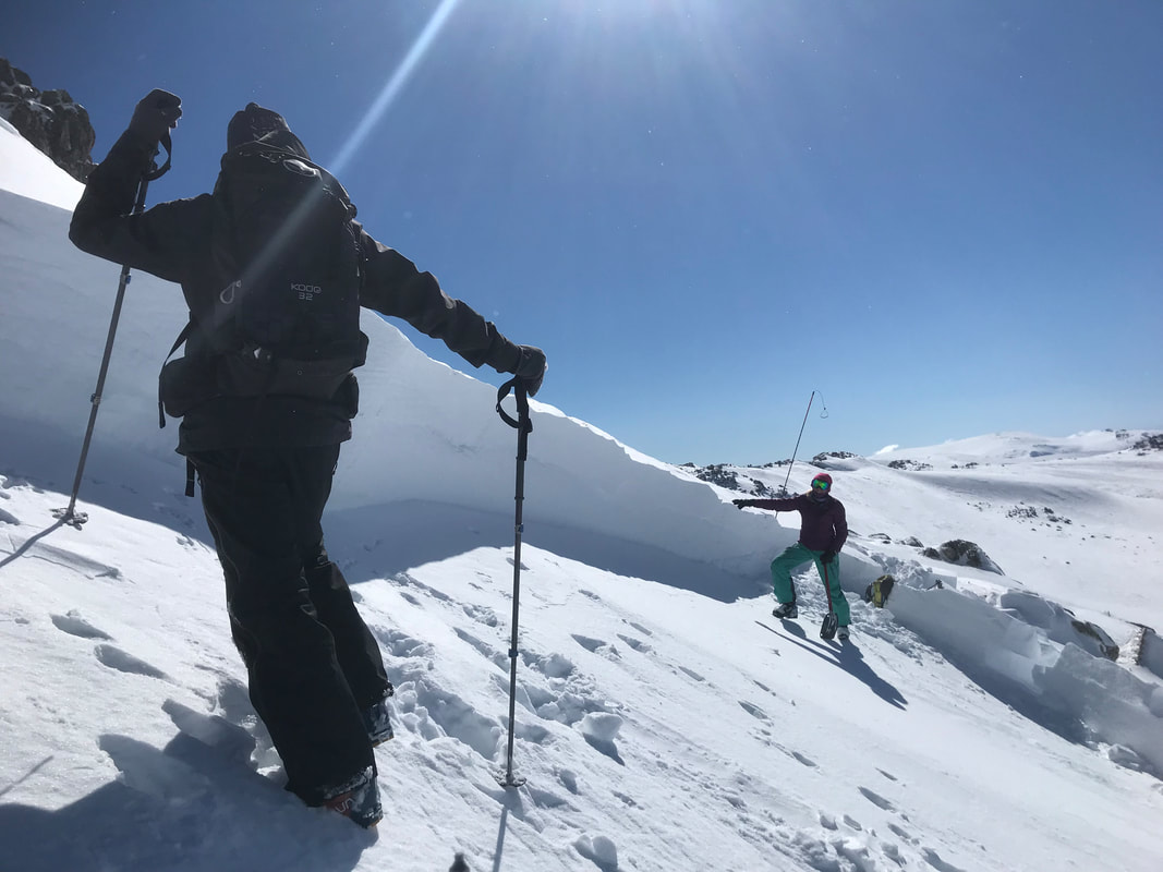
The below human triggered avalanche occurred at ‘Etheridge’ on the Main Range during the first warming event (+1˚ at midday Tuesday) since the storm and hence the continued ‘High Danger’ rating being issued via this service. This east aspect of ‘Etheridge’ is steeper than it appears in this photo, far from a conservative terrain choice and a close call. Luckily not fatal, just, with only a head and arm above the debris. Remember, most incidents occur on Moderate and considerable danger rating so the below summary urges vigilant consideration of avalanche hazard required for safe travel in the backcountry. See also below, the incident of a remote triggered avalanche of considerable size in the headwaters of the Leatherbarrel Creek drainage.
This ‘Etheridge’ involvement is certainly the largest observed avalanche event recorded to date by this service, let alone one where the victim walked away.
Incident Report
From Alpine Access
Etheridge Ridge Avi Obs 140819
2100m east aspect, gradient 35+ degrees .
Human-triggered, victim was buried and lucky to survive with relatively minor injuries. Not sure the photos do it justice, do not underestimate how big this is. What you see in the photos is not a cornice but the crown, varying between 3m and 1m. Propagating for 400m under a convexity. Sliding on an old meltfreeze layer of breakable crust and running for approximately 300m. Human-triggered from lookers right with what is described by the victim as ‘a thunderous boom’ as it propagated. The entire depth of accumulated snow from the last storm cycle has let go. Several layers of surface hoar and graupel were evident in the debris but a CT Test we did at the crown only produced a CTH25 on the bed surface layer.
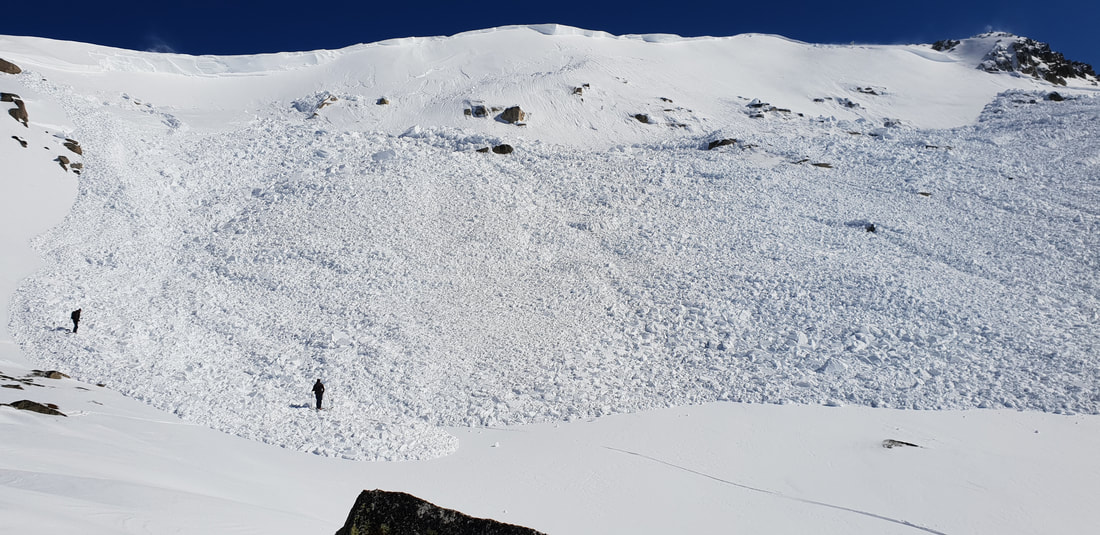
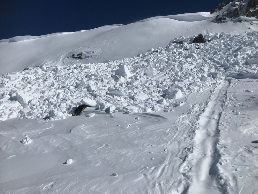
When we first got a look at the extent of the slide, all four of us agreed it was a size 4 but on reflection due to the short runout, we have revised it down to a size 3. There are blocks the size of kombis and one portion of the slab still intact could be the size of half a basketball court.
With this and other reported slides in the last few days, it is evident that the storm snow has become cohesive and formed hard slabs, able to propagate and release with appropriate loading. Underneath the meltfreeze crust that this slab released on, we found a substantial layer of low-strength sugary crystals which is also of concern. All this information justifies a conservative approach in the backcountry at the moment.

Here is the temperature weather graph of the ‘warming period’ that followed the weekend storm and correlates with the incident featured above.
From Monday Night:
Field Obs. 13/08/19
Plenty of people out and about on the Main Range Sunday and Monday. A few reports of small size 1 and 1.5 natural wind slab slides on SE aspects above tree line. One at Twin Valleys and we saw one on Mt Wheatley on Sunday during our AST course. Could have been cornice triggered or from new snow loading.
Cornices are touchy and wind has loaded bowl features on SE aspects especially. Generally however there was no sign of propagation in the light dry snow (did I really just say that) and you could not even make a snowball on Sunday. Yesterday things had changed a bit on solar aspects. Our pit revealed varying levels of density and several surface hoar and graupel layers but nothing popped.
Despite improving conditions and confidence caution, careful analysis and good decision making remain essential. Thanks Kyle Boys for the intel and if you see anything out there please let us know. Stay safe. DH
OBSERVED HAZARDS & ACTIVITY
• Very Large human triggered avalanches occurring.
• Small / Medium natural avalanches observed.
• Considerable Wind Slab Avalanche hazard exists.
CURRENT SNOWPACK CONDITIONS
We have 30cm - 60cm+ fresh snow sitting atop a very firm and in places slick bed surface. This fresh snow has an uneven temperature gradient starting at -3.5˚ in the new snow above the bed surface of -2˚, ranging to -5.5˚ / -8˚ at the top. These number alone are cause for alarm. Density variation and poor cohesion both in the fresh snow pack and to the bed surface likely.
PRIMARY HAZARD: WIND SLAB

Secondary Hazard: ICE & RIME

ALPINE WEATHER
Variable warmer and windy conditions will prevail ahead of a colder spell arriving Sunday.
CONDITIONS Outlook
IMPROVING / ONGOING / DETERIORATING

Scheduled Observations

MT TATE & GUTHEGA TRIG AREA
BACKCOUNTRY CONDITIONs:
NA

SOUTh RAMSHEAD &
DEAD HORSE GAP
BACKCOUNTRY CONDITIONs
Monday 12th August: Leatherbarrel Creek. Remote triggered from about 30m away on the ridge riding past this bowl - noticed a shooting crack which instantly appeared when I stopped red (riding) yellow (crack) lines - crack ran the whole ridge approx 300m - figure it’s from nw loading wind slab being buried under wind scour/sastrugi which hid the obvious signs and added weight to that layer. Very touchy. Bowl below ramshead (honey bowl skiers left of the spur) 1900m approx se facing - crown 60cm approx 50m wide - ran 200m - also triggered a secondary slide through rocky terrain approx 50m down


