MAIN RANGE NSW:
RECENT OBSERVATIONS
UPDATED: 23th / AUG /2018
REPORT CONFIDENCE: STRong
CURRENT UNTIL: 27th / Aug / 2018
OBSERVATION SUMMARY
TREND: IMPROVING / ONGOING / DETERIORATING
RECENT OBSERVATIONS
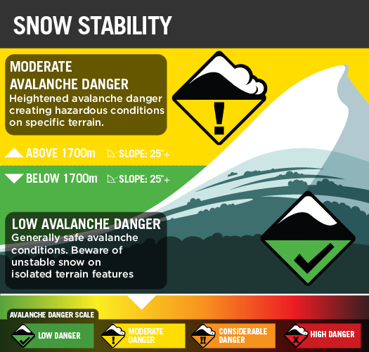
moderATE AVALANCHE DANGER.
tHURSDAY
Improving weather has brought the danger back to moderate above 1700m and Low below 1700m. The layer that was giving plannar results @30cm has improved and is now not a concern. The layer @85cm is still reactive so will will keep an eye on this. The only signs of instability are some pinwheels with warmer weather.
OUTLOOK
Snow looks to be coming on Sunday PM so next week should see snow down to 500m. So go and get amongst it , Saturday is looking to be the best day with light winds and some cloud.
Always a big thanks to everyone who is helping make this possible through our membership kickstart and through our merchandise drive.

PRIMARY HAZARD


SECONDARY HAZARD


Recent Snow Profiles
10/08/2018 Cornice collapse
10/08/2018Melt / Freeze
10/08/2018Buried Graupel
10/08/2018 Buried Graupel
10/08/2018CTE 2 SP @20cm on buried surface hoar
10/08/2018CTE 9 SC @61cm on the buried graupel.
10/08/2018ECTP 3 @ 20cm on the buried surface hoar
03/08/2018 Pit results
Layers
CT SP result no.1
CT SP result no.2
29th July 2018
July 27th
July 15th 2018
July 1st 2018
June 24th 2018
June 18th 2018