Date: 19/08/2020
Conditions Summary
Yesterday there was 5cm of new moist snow over a crust. The crust was approximately 8cm thick and supportive to skiing by not to walking.
The new snow was not bonding well to the crust and ski cutting produced isolated small loose avalanches on steep (30deg+) slopes at 1800m.
We had no observations from the alpine yesterday.
Alpine Hazards


Sub-Alpine Hazards


Daily Discussion:
The storm continues. Winds are forecast to be high to extreme (>60km/h) out of the NW. Temperatures are forecast to decrease throughout the day. It is a good day to seek sheltered sub-alpine areas to enjoy the new snow.
Be prepared for whiteout navigation.
Avalanche danger will increase with the forecast snow and winds.
Dress warm and carry extra layers.
Confidence: MODERATE
Models still vary regarding forecasted amounts of snow.
Avalanche Problems
Primary Problem
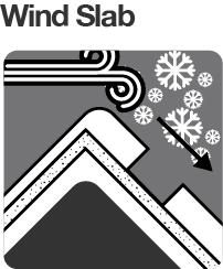
High to extreme NW winds associated with the new snow will form stiff wind slabs in the alpine.
Evaluate snow and terrain carefully; identify features of concern.


We need your eyes too. If you’ve been touring in the Alpine National Park we’d love to know what you have seen. Every little bit helps.
Weather Summary
Cloudy. Very high (95%) chance of snow showers. The chance of a thunderstorm in the late morning and afternoon. Winds northwesterly 50 to 70 km/h increasing to 60 to 80 km/h in the early afternoon then turning westerly 55 to 75 km/h in the evening. (Source: BOM)