Date: 18/08/2020
Conditions Summary
The rain of the past week and the warm temperatures have left us with a well settled snowpack in the alpine. In the sub-alpine however, lower elevations have patchy cover and the snowpack is unsupportive in many areas.
That is all about to change with the next storm. Temperatures are forecast to decrease, winds increase, and snow start falling. Let’s get back to winter!
Be aware that conditions can rapidly change in the coming days if the forecast holds true.
Daily Discussion:
A cold front is forecast to come into the area today. Expect increasing winds, decreasing temperatures, and snow.
Be prepared for whiteout navigation.
Avalanche danger will increase with the forecast snow and winds.
Be cautious crossing rivers on snow bridges are weak and may collapse.
Confidence: MODERATE
Models are conflicting regarding the forecasted snow amounts today.
Avalanche Problems
Primary Problem
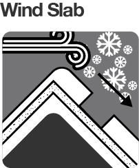
Avalanche danger is currently low, but will increase throughout the day. Watch for windslabs in the alpine.
Evaluate snow and terrain carefully; identify features of concern.
We need your eyes too. If you’ve been touring in the Alpine National Park we’d love to know what you have seen. Every little bit helps.
Weather Summary
Cloudy. Very high (95%) chance of snow showers. The chance of a thunderstorm late this afternoon and evening. Winds northwesterly 35 to 50 km/h. (Source: BOM)


